Other PicoMicroYacht

Thursday 25 August 2022

Why so slow?

PicoMicroYacht can cruise at about 3 miles per hour or 2.6 knots, approximately at human walking speed.

I have to admit, I enjoy this comparatively slow speed, and the rhythm of the oars and the tide takes me into a different place, maybe the slower world of our ancestors.  

Example of ancient and slow:  A reed boat, still used for fishing in Peru. Such boats go back as far back as 12,000 BC

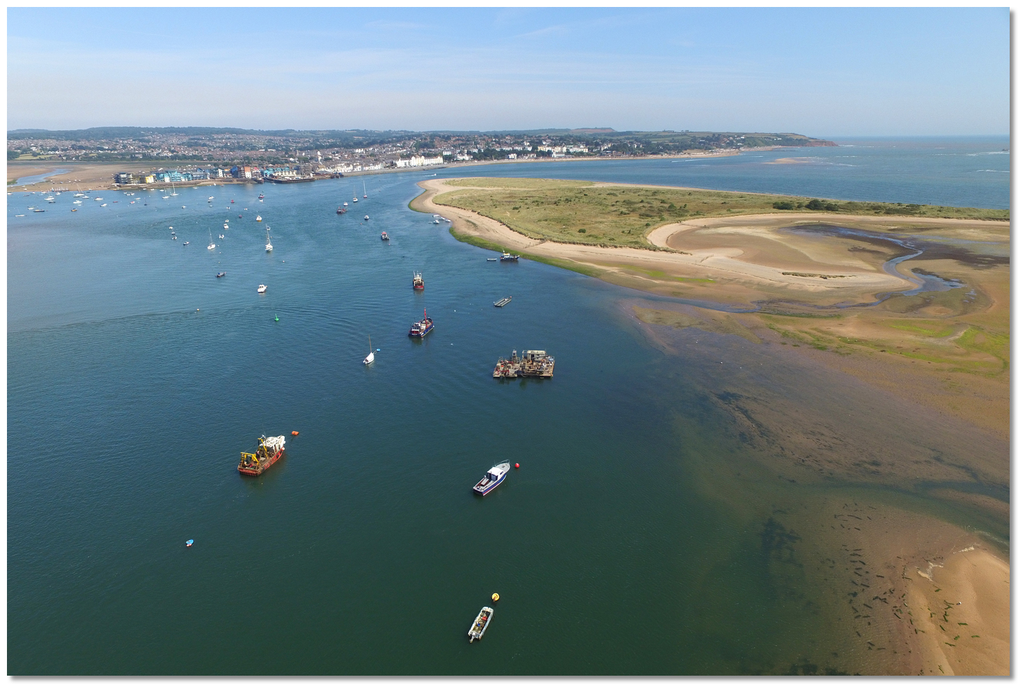
I realise my slow speed is not for everyone. I took my daughter and her partner out in a 21 foot sailing boat. We left the marina and settled down to about five knots in the adjoining estuary. This was too slow for my daughter who immediately said 'what now?' - meaning 'Is that it?.'  I was only able to convince them to continue by explaining that sailing can be a mindful experience and that the thing to do was to spend time meditating on the sea and sky. I suspect they spent the rest of the voyage humouring me, but they were very polite.

So why is PicoMicroYacht so slow? 

Recently, I discovered there is a well worked physics of maximum boat speed relative to design.

The starting point is what happens when a displacement boat goes through the water. Two wave forms are created, divergent waves which spread sideways (I call them the bow wave) and transverse waves that go in the direction that the boat travels (is that the stern wave?). The wave combination creates a feathery triangular pattern, as modelled below. The transverse waves are critical to boat speed.


From 'The Physics of Boats' https://www.youtube.com/watch?v=OaRfXthP8fw&t=165s


From 'Why do boats make this shape? https://www.youtube.com/watch?v=95sQcSulRFM&t=148s

I discovered also that water waves travel at different speeds, unlike light or sound waves. The faster the wave the longer the distance between the peaks of the wave.  If you are on a beach and want to judge the force of the waves, count the seconds between each peak as well as looking at the height.

All this is relevant to boat speed as follows: 

When a boat speeds up it creates faster transverse waves which are more separated. The boat 'sits' in the transverse waves and as these get longer it gets to a situation where only two peaks are aligned to the length of the boat hull, one at the bow and the other at the stern. 


From: https://www.youtube.com/watch?v=OaRfXthP8fw&t=165s

If the boat then tries to go faster the wave length exceeds the boat length;  the boat tries to 'climb' the wave at the bow, the stern settling into the trough between waves. 


The force needed to 'climb' stops it getting faster. The only way out of this situation is for the boat to have substantially more power which boosts it onto to a plane; only then will the force needed to travel at a higher speed decrease.

Rowing boats do not plane because oar power is not sufficient to get them to this level. It follows speed is limited by length, which is why racing rowing boats are very long. The length of a racing sculling boat is about 27 feet, over double the length of PicoMicroYacht.

Of course, even though boat length defines the theoretical maximum speed, there are other factors that determine actual speed, such as hull shape, weight and hull smoothness. 

The weight is important because it determines how much boat is in the water and therefore the amount of water the boat has to displace to move forward. 

The shape determines the efficiency of the boat being able to displace the water. 

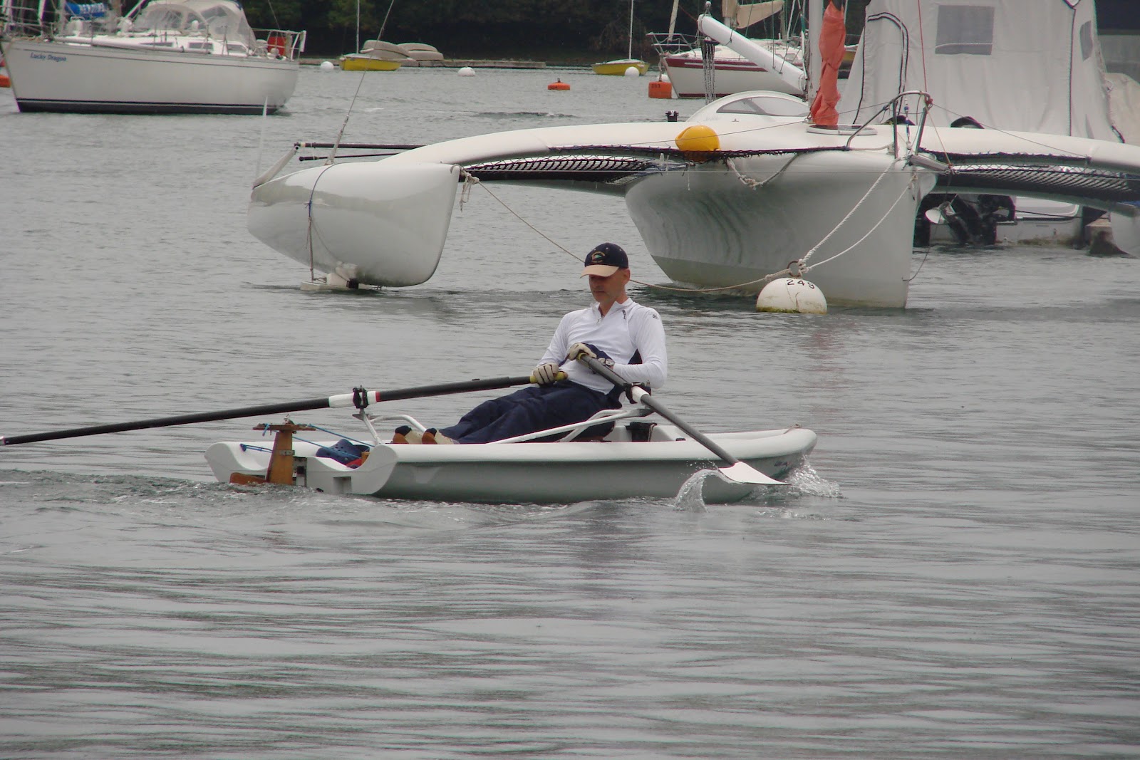
PicoMicroYacht in the Salcombe Estuary

PicoMicroYacht is relatively heavy, being made of rotomoulded plastic. It has a narrow bow, but it somewhat flat in the water, with enough width for it to be fairly stable (1.43 metres). PicoMicroYacht  sacrifices speed to create strength and what is called 'form stability.' 


Rowing in a racing sculling boat in Rio de Janeiro


In contrast, racing sculling boats are made of light materials such as carbon fibre and are very thin, between 26 cm and 30 cm, their stabilty determined by initially skimming the sculling blades along the water surface, body inertia in movement, and water flow over the hull. 

The width and weight of PicoMicroYacht ensures that there is much more surface area in the water, with greater displacement and friction, hence the relatively slow speed.

One way of determining speed efficiency is to compare the actual speed to the theoretical maximum speed. Equations have been developed to calculate the latter, the one most quoted, being 1.34 X SQRT (Boat Waterline Length). PicoMicroYacht in theory could be rowed up to 4.5 miles per hour. 

This got me thinking about how fast a single person can possibly row. In terms of international rowing competitions, the standard distance is 2000 metres.The fastest official time at this distance is by Robbie Manson, a New Zealander, who did it in six minutes 31 seconds in 2017. This translates to about 11.45 miles per hour. 

Of course, put a racing sail on PicoMicoYacht, go out in some wind, and it may even go faster than this.


Sunday 21 August 2022

Exmouth to Teignmouth using tricks

PicoMicroYacht has almost completed voyaging from the Thames Estuary to  Cornwall. There are just a few gaps to fill. This summer I completed one of them in Devon, between Exmouth and Teignmouth. 

This voyage takes you out of Exmouth Harbour and down the Devon Coast past Dawlish.


The coast from Exmouth to Teignmouth. The black line marks the path of the main South Western  Railway designed and built by Isambard Kingdom Brunel.

For a small dinghy without motorised power, the voyage presents several challenges, which I enjoyed overcoming, PicoMicroYacht being well suited for this type of voyage.

The Exe Estuary entrance - from eOceanic

One is launching a boat, which I did on the west side of the Estuary. I found on Google Maps a launching site just south of Starcross, by a village called Cockwood. There is a small tidal lagoon separated from the estuary by a railway embankment and it is possible to exit the lagoon through a tunnel. I got there early and the lagoon was empty, but I realised I could tow PicoMicroyacht across a muddy track and out through the tunnel onto a beach to launch.


PicoMicroYacht was eased down a slipway to be turned and pulled along the muddy track.

Going through the tunnel. The mizzern mast, already put up, was just low enough to get through.

The next challenge was to leave the Exmouth Estuary against the tide, since this would give me more time to take advantage of a south flowing tide in the sea, To start with I rowed around the Bight, shown below, keeping close to the shore (left to right).

The Bight, to the south of the Exmouth Estuary  - from eOceanic.

In the actual entrance the tide was ripping at great pace. I kept really close to the shore, with my starboard blade about two feet away. This seemed to do the trick and get me out of the estuary, rounding Warren Point.


Warren Point (middle of photograph) - from eOceanic.

Outside the estuary and to the south are treacherous sandbanks. Normally these are avoided and the channel takes you north of these sandbanks far to the east. However, it was very calm and the tide was high enough for me to head south, cutting many miles off my journey. I went over the Pole Sands and the aptly named Monster Sands.

Google Earth shows how wave break around the entrance the Exe Estuary, the sandbanks very harzardous to shipping.

Eventually I was free from worry about being over sandbanks and heading south. It is along this coast that the railway, designed by Isambard Kingdom Brunel, hugs the shore. I could see the trains in the distance going up and down, looking like a model railway.

It was a sunny July day, the sea sparkling blue, and good progress was made.

Arriving at Teignmouth I had the opposite problem to Exmouth. Now the tide was exiting the harbour fiercely and this time too fast to row against.  I had enough tide to get over the Spratt sands and the trick  now was to get out of the boat, towing it round the Point and into the harbour on foot. 

All this was possible because of the very calm conditions. If not suitable, entering the harbour can be dangerous, particuarly with wind from the east. The Harbour Master's advice is that generally entry is manageble if the right precautions are made, and sailors are encouraged to seek advice if in doubt.


Admiraliy Chart - to be found on the Teignmouth Harbour Commission website, which provides good advice about harbour entry.

The Point, on the north side of the Teignmouth entrance.

As I went round the Bight I had to avoid some fishermen, who helpfully lifted their lines over PicoMicroYacht, without complaint.

Once in the harbour I was able to find a slipway close to the lifeboat station.

This voyage, some eight miles, had gone without incident, mainly due to the calm sea and slight winds. 

Some illustrations in this post are from eOceanic, designed and produced by sailors for sailors

 https://eoceanic.com/sailing/harbours/522/the_bight 


King's Lynn to Hunstanton and then to Wells-next-the-Sea

I stayed over night in King's Lynn, with PicoMicroYacht moored on a pontoon. The next day is was sufficiently calm to set off early for the Wash.

Although the river is fronted by many building, the twin towers of King's Lynn Minister still dominate architecturally.


King's Lynn has been transformed into a tourist town, but the industrial parts are still very active, including ships docking.


These ships face a tricky passage through the Wash and out into the North Sea, so the pilots are needed to navigate them. 

A pilot boat was coming in from the sea, the pilot finished. The pilot boat slowed so as not swamp PicoMicroYacht and then accelerated away.


The strength of the tide meant it was not that long before I had reached the Wash and was following the channel between the marker buoys. The thin land on the horizon accentuated the sea and the sky. 


Out to sea I was followed by seals, some of  whom got really close to me.


I rowed steadily across the calm sea, for several hours until I reached Hunstanton, with it's prominent seaside hotel type buildings.


Out to sea an unusual amphibious ferry was providing some fun to holiday makers.


Because the tide had gone out I had transport PicoMicroYacht across an expanse of sand. To do so I assembled my portable trailer, hauling PicoMicoYacht over the particular sand impossible for me. Nevertheless, it was a very hard pull to get PicoMicroYacht off the beach, the wheels of the trailer tending to sink in.

On another day, without being able to take any photographs because of camera failure, PicoMicoYacht voyaged round to Wells-next-the-Sea. This trip was about 17 miles, made easier by catching tide out into the North Sea and along the North Norfolk coast. I stayed about a mile out to sea to ensure a straight course and avoid and sandbanks. From here you can glimpse parts of ports against the very flat coastland.

The timing meant that when I arrived at Wells-next-the-Sea, the tide was going out, quite fiercely. Normally there is about a mile navigating between sand banks before getting into the harbour entrance. 

To avoid a rowing this against a strong ebb tide, I was able to skirt diagnonally over the West Sands, with a few inches to spare, this only possible because of the very calm weather and no  waves. 

PicoMicroYacht was beached near the lifeboat station.


Thursday 18 August 2022

PicoMicroYacht goes from Cambridge to King's Lynn

The next stage of my journey was from Cambridge to King's Lynn a distance of approximately 50 miles, starting on the Cam and then via the Great Ouse to Ely. The last part of this voyage involved exiting into the Tidal Great Ouse. The whole journey took  three days to complete. 

I set off from the Wolfson College Boathouse, the river busy with rowing craft out practicing.


The narrow Cam in Cambridge has to be carefully negotiated

I passed the the Plough pub, a favourite place to walk to from Cambridge. 


The Plough Inn, a welcome watering hole for Cambrige folk

The Cam became less crowded as I moved fully into the country side. Some six miles outside of Cambridge was the Baits Bite lock and there I discovered that this and the remaining lock were electronic and I did not have a key.


However, there was passing traffic, so I was able to rely other another craft to operate the Baits Bite lock, including lifting the guillotine gate to let me through.


I next encountered the Cam Sailing Club, which seemed to specialise in classic or picturesque boats.


I felt as if I was making progress, but when I got to Bottisham Lock, a canal boat owner there told me there was a full nine miles to go to Ely. He kindly operated the lock to let me through.


I knuckled down and was relieved to eventually see Ely cathedral appearing in the distance, the last few miles appearing to go very quickly.

In the next trip, I set off for the Denver Sluice, about 15 miles away. I soon went past the 5 million pound Cambridge University Boat Club Boathouse, strategically located here for rowing long training distances without being interrupted by other river traffic.


Further down stream some oarsmen were out training, looking neat and strong. It was well after the boat race and I was wondering what they were training for.


It was quite a slog to reach the Denver Sluice, but on the way I saw an interesting site, a seal that had somehow got through into the non-tidal Great Ouse, now lying by a bench. 


A further few miles and I was at the Denver Sluice, where there is another rowing club.


The third trip to cover the last 13 miles to King's Lynn, going through the Denver Sluice complex at the start of the voyage. Although not massive, it is world famous because it is important for the drainage of land between it and Cambridge some 35 miles away. If the sluice did not function, water would course inland for about 25 miles, overcoming the riverbank and flooding vast land masses, destroying villages and small towns.

There is a lock joined to the sluice, allowing acccess to the tidal Great Ouse. To get through the tide has to be near high. For me, it also had to be ebbing because it was too strong to row against.


Timing the tide correctly meant that it would get dark before I got to Kings Lynn. Because of this, the lock keeper looked somewhat concerned and asked whether I would make it? I confidently replied I would, but he made a point of taking a photograph of me for his records.

 Later on I did see a notice asking people not navigate this stretch of the river in the dark.

The tide gathered up pace and helped me along, but it was soon getting dark and I was having to be very careful to not run into any bridges. More dangerous obstructions were two dismantled bridges, leaving some pillars just sticking out from the water.

Although it eventually got dark, the night was clear enough to make out the various hazards as I approached Kings Lynn.

The next challenge was to find the pontoon and not be swept past by the tide. Since the tide was now faster than I could row, I had to turn PicoMicroYacht round and rowing gently forward whilst going backwards down the river, ferrygliding into position. This had the advantage of being able to see where I was going. 

At the opportune moment I grabbed a cleat on the pontoon, held on determiningly, wrapping a rope around it. 

If I  had missed, a plan B had been to find a slipway further down the river. Beyond that for plan C I had an anchor to stop me being washed out into ... well the Wash. 

I had arrived at Kings Lynn.