The blog records the voyages of PicoMicroYacht, a seaworthy small sailing dinghy converted for rowing long distances. This includes the 26th July 2012 crossing of the English Channel, as well as rowing along the south coast of England, down the river Thames, around London and across Ireland. PicoMicroYacht is a converted Laser Pico Sailing Dinghy, with a sliding seat, riggers and cleaver oars, fitted with a shortened main mast and a mizzen mast and can be set up as a reduced rig sailing boat.
I haven't been able further explore the Jurasic Coast so far (see previous post).
As an interlude I decided to voyage from Rye to Hastings. The navigation is simple; follow the coast and keep clear of ledges close to the shore.
I regard Rye as a proxy home port for PicoMicroYacht. This is because Full Throttle Boat Charters is based there, and they provided the backup for the PicoMicroYacht English Channel crossing.
Walking through Rye Port, I saw the rib that accompanied me, tucked into a boat park. I paid homage by sneaking a photograph.
Spot the rib in the background
PicoMicroYacht was then launched and drifted away from the slipway as I put the oars in their gates.
Near the entrance the sea was calm but the clouds heralded more wind.
Out to sea there was a crude but effective navigational tripod.
I was heading west, passing a flat coast that eventually gave way to sandstone cliffs.
Just before the cliffs is a beach called Pett Level. The beach and nearby cliffs provided a backdrop for David Bowie's 'Ashes to Ashes' video.
I quickly moved on, reaching Old Hastings in less than an hour. Here the fishing boat are hauled up on the beach, looking even more scenic from the sea.
The tide and wind continued to push me on and I overshot Hastings to reach St Leonards on Sea.
A convenient small reef calmed the sea and created a lagoon, making it easier to land without swamping.
The voyage took 3.5 hours, covering the 12.5 miles from Rye Port to St Leonards on Sea.
David Bowie's Ashes to Ashes video at Pett Level
The Ashes to Ashes video was directed by David Mallett and David Bowie in 1980, and includes stunning visual effects achieved using just camera settings and filters.
David Bowie on the beach with his 'mum'
As well as showing the Pett Level beach, the video ends with an actress cast as David Bowie's mother. She is shown remonstrating with him, because the song finishes with the refrain: 'My mother said, to get things done, you had better not mess with Major Tom.'
This was the start of PicoMicroYacht’s voyage along the
Jurassic Coast, which stretches 96 miles from Studland to Exmouth. People visit
this World Heritage site from all over the world, walking the coast trail. I
don’t really advertise on this site, but the below map shows the type of
walking trail holiday that is possible.
The plan was to go from Swanage to Kimmeridge (just before Lulworth Cove), an
approximate ten-mile distance. In PicoMicroYacht, the voyage had to be planned
carefully.
The main consideration is going round St Aldhelms Head,
sometimes calls St Albans Head. This is the most southerly point on this part
of the coast and has a formidable race. As described by Peter Bruce’s ‘Inshore
Along the Dorset Coast’ the race is caused by ‘a four-mile-long precipitous
underwater ledge, which by halving the depth, can throw up furious breaking
waves.’
St Aldhelm's race inside passage on not such a good day
To avoid the race, it is possible to go via an inside
passage, but this may disappear in the wrong weather conditions. At spring
tides the rate can be up to three knots, which is the PicoMicroYacht speed. If arriving at the wrong time, you may be nevertheless committed to going through the
race.
I decided to pass St Aldhelms Head at low
water slack and ensure it was at neaps.
I planned to take a fair tide from Swanage to St Aldhelms, arriving as the tide halted. It would then set against me for the last
few miles to Kimmeridge, but not have time to build up to full force.
Another factor when rounding the head is the counter current that greets you from the western side.
It is quite powerful and can push you back into the race area. By going at slack water and neaps, I would avoid the worst of it.
Technical information about the currents around St Aldhelm's Head, also showing the counter current eddy when the tide is to the west. Also marked is the inshore passage.
Time lapse modelling video of the tides around St Aldhelm's (has Portland Bill as well)
As well as focusing on good timing I made sure the sea was smooth or slight and there was a light easterly
wind to help me on my way.
Another factor is that the Ministry of Defence use these parts of the
coast as firing range, including shooting shells and missiles out to sea. They do not fire at weekends.
Having all these constraints means there are not many opportunities to do the voyage, so when all the right conditions were in place I went for it.
I set off early from Swanage Sailing Club, who were very
helpful and friendly. Knowing about my voyaging from a previous email, they allowed me to
launch from their beach, rigging the boat the night before. A club
member even helped me with an early morning launch as we dragged PicoMicroYacht down the
beach into the water.
Just outside Swanage is the Peverill Point race. This is caused by double vertical underwater walls or ledges, which can kick up a vicious sea. I was very nearly pooped there in a 23 foot yacht – some water lapped over the stern. Despite this, the club convinced me it was alright to go through the race
at neaps, which they do in their club dinghies It was lumpy going, but I felt very safe.
Looking back at Swanage and the Peverill race
When nearly through the it, a fleet of jetskis came in my direction, spread across the horizon
They closed in on me and passed either side, seemingly unperturbed by the bumpiness of the race.
The tide then pushed me down to Durlston and Anvil Point. A slight swell was keeping the sea lumpy.
As I passed the headlands, I was well ahead of schedule for reaching St
Aldhelm's Head at slack tide.
I decided to call up the St Alhelms Head Head National Coastwatch Institute
(NCI) lookout station to ask for advice concerning whether the conditions would be good enough to pass through the inner passage.
They predicted the race would get worse in an hour, which is when I would arrive if
I kept going at the same speed. I could see the race in the distance, with the agitated motion of the waves silhouetted on the horizon. So I decided not to risk things, but to drift a bit to slow progress.
My GPS position, showing the PicoMicroyacht location when drifting
As I drifted along, I reached a place called the 'Dancing Ledge' an area of flat rock towards the base of the cliffs. This facilitates people reaching the sea from the cliffs above and is a popular bathing place. Some people had decended from the ledge and were being trained in coasteering. There were two swimmers nearby, also onlookers.
The coastering students under instruction
I now had two miles to go to reach St Aldhelm's Head. As I slowly approached, I was caught up by some kayakers. We chatted for a while and then continued.
When I eventually arrived at St Aldhelm's Head there was no race to be seen.
Just about to round St Aldhelm's close in - a semi-submerged rock can be seen ahead
I had been told that there was deep water in the inner passage. I rounded the head and was able to see the bottom, but I was very close in.
Very close in and the bottom visible. Not a place to be in a yacht
I radioed the NCIs lookout station to indicate my presence. The person on duty exclaimed rather spontaneously, ‘you are not
going very fast.’ I explained my lack of speed since it is not possible to row and radio at the same time. I reflected on the fact that the NCI volunteers do an incredible job keeping an eye out for difficulties, there now being no paid coastguards to do so in such parts.
Looking up at the NCI lookout station, just visible over the cliff
Having rounded the headland I was met by the counter current and rowed hard. I persevered and eventually approached Kimmeridge, the grey cliffs contrasting with the green blue sea.
Close to Kimmeridge bay I saw the distinctive Clavell Tower. Built as a folly in 1830, it was used by coastguards and has recently been saved from falling into the sea. It inspired the novelist Thomas Hardy in his poetry writing, who is said to have there wooed his first love at the tower, a coastguard's daughter.
The Clavell Tower - a useful landmark
Just inside the bay, I saw a red float in the water. Then some bubbles appeared, and I realised it
marked a diver. I found out later that divers are frequently out in the bay, so one should keep a careful lookout for them.
I could see the slipway and the huts behind, including the Wild Seas Centre.
On arriving a warden helped me pull
PicoMicroYacht up the steep slipway. He had seen me coming from the Clavell tower. I don’t think I could have managed on my
own.
Kimmeridge is a favourite for photographers, having readily accessible compositions and dramatic lighting effects with the right weather conditions.
A good illustration of the power of the St Aldhelm's race is in the video below.
Selsey Bill is a tricky headland to navigate because it has
a series of limestone ledges stretching far out to sea. Yachts are wary and many have been
lost here in stormy weather. Perhaps the most well known casualty is the ‘Morning
Cloud III,’ a racing yacht belonging to the then UK prime minister, Sir Edward Health. The yacht capsized and sank off the Bill, the crew taking to their life raft. Two people died, including Sir Edward Heath's godson who was swept overboard before the yacht sank.
Selsey Bill on the left with Pagham Harbour infront and the Isle of Wight behind it. The Isle of Wight provides some protection from the prevailing Westerly winds, but not completely.
(from eOceanic)
There is an inside passage about a mile out to sea which goes
between two buoys called Boulder and Street. This is reasonably safe, but it
means putting your boat in the jaws between dangerous ledges, so it tends to be
avoided other than in relatively calm weather.
The ledges of Selsey Bill - the chart highlights the 'Mixon Hole' the segment of an old river gorge, now submerged, previously used by the Romans for transporting goods. Boulder and Street are to the bottom left and there are further ledges out to sea not shown on the map
I elected to go close in round the tip of the Bill at high tide, so to have
enough water over the ledges.
It was all about timing. I had to ensure the tide was with me
to the Chichester Harbour entrance. I also had to be at the entrance before the ebb tide coming out got
into full flow, or it would be very hard getting in.
The compromise was to leave Sesley Beach at about 1.5 hours
before high water, arriving at the Chichester Bar about half an hour after high
tide.
As I was launching PicoMicroYacht the tide was still against
me, but it almost immediately turned in my favour and I was swept past the tip of
Selsey Bill.
Out to sea I could see a yacht motoring through the inner
channel, by Boulder and Street. The sea was not particularly calm.
As I turned westwards, a head wind got up and it was hard
rowing. I passed a series of sea defences and behind this was a windmill, a
characteristic landmark.
Although I had planned for a calm sea, there was a moderate
swell and I could hear the roar of waves breaking on the beach.
Closing in on the Chichester entrance, the sea calmed under the lee of the Isle of Wight and I passed between two cardinal markers warning people of wrecks on the East Pole Bank, outside the harbour.
Looking south I saw the South Cardinal mark, with the characteristic upturned triangles, signalling to ships it is safe to pass south of them. A bird sat on the mark, making the silhouette less clear. Being high tide, it was safe to proceed.
I was relieved to reach the entrance and find only a slight ebb tide. I was able to make quick work of entering the harbour and rowing up to Mengeham Rythe Sailing Club.
Just outside Mengeham Rythe Sailing Club, with full calm restored.
Passage planning:
Tide: Dover high tide: 17.30; Chichester high tide: 17.56. Tide turns west Selsey
Bill – 1-2 hours before Dover high tide. Left 16.05: arrived at Chichester bar 18.20
This was a small journey between Pagham sailing club and
Selsey Bill, but not uneventful.
I set off from the club with the help of two members who pulled me off the beach whilst I was getting my oars into position.
Pagham Pico and Topper sailors, two of which helped me launch
I decided to skirt past Pagham harbour just before high
tide. I got there early and as I passed the entrance I realised I was being
sucked in, and immediately tried to escape.
The height difference between the outside sea and the entrance can be seen - I had to grab the camera, quickly take a photograph and return to rowing
After about 20 minutes inching forwards I realised it was
futile to keep trying. I turned to enter the harbour.
As I did I spotted a confused area with what looked like surf fast approaching.
Anxious to avoid this, I ferry glided across the western side of the entrance,
to the Church Norton Spit, where there was a counter current sufficient to stop
me being sucked in further.
I paused and realised it was the best to get out for a rest.
I carefully attached a long rope to the bow and disembarked, tying the rope to
a convenient post.
As I looked across the entrance, I saw how dangerous it
could be if you were sucked into the harbour in a small sailing dinghy with no
other propulsion. The area of confusion had a sill which was creating a large water drop and tow back.
The risk was much larger
than I had imagined earlier on.
The tide started to slow, and I got back in to PicoMicroYacht,
letting it drift into the harbour.
There is a notice board at the entrance to the harbour. If you look closely you can see some new red paint covers something up. It used to say 'No unauthorised boats permitted' which was technically true except that there has always been a public right of navigation on all the tidal waters in the harbour, so generally there were no unauthorised boats that would not be permitted (interesting grammatical issue). This was probably why someone painted over it.
However, even though it is legal to visit by boat in the tidal areas, some respect is needed, so I did not linger long. I rowed back to the entrance against the diminishing tide and made my escape.
The area of relatively quiet water between Pagham and Selsey Bill has been seen as a lagoon. In fact, it was here that Eric Coates was inspired to compose 'By the Sleepy Lagoon' on a still summers's evening looking back towards Bognor Regis. There are many different versions, including ones with lyrics.
Dinah Shore singing 'Sleepy Lagoon' in 1942 - this version creates a strong sense of nostalgia, probably also intended for the war effort
Soon I was at Selsey Bill and a kindly motorboat crew helped
me up the ramp.
The motorboat crew
Passage details:
High tide at Portsmouth was 13.47. A westerly going tide was expected one hour
before this, with approximate slack two hours before. High tide in Pagham
Harbour was forecast to be about 14.00. I set off from Pagham Sailing club after
13.00 with the aim of arriving just before 14.00. The tide was still going
strongly into the harbour and this did not stop until 15.00, when I was able to
escape.
After this voyage I got interested in how a back tow worked. I found this useful video, which is quite salutary and perhaps should be viewed by all tempted to mess about at weirs.
This is the first of three posts describing a voyage from Felpham to Chichester Harbour via Selsey Bill.
My first row was from Felpham to Pagham harbour, just a long the coast, returning to Felpham on the same day.
Felpham is a small village to the east of Bognor Regis. Launching there is very civilised, with a good slipway leading down to hard sand at low tide.
Close to the slipway is the lovely cottage where the poet William Blake wrote 'Jerusalem' with the lines: 'I will not cease from mental fight, Nor shall my sword sleep in my hand. Till we have build Jerusalem in England's green and pleasant land.'
Felpham is mentioned in a Blake poem: 'Away to sweet Felpham, for Heaven is there. The ladder of angels descends through the air.' He claimed to have seen visions of angels on many occasions, starting aged eight years old, when walking from Soho to Peckham in London.
I didn't see any angels but was more preoccupied with launching PicoMicroYacht, having only one hour of fair tide left.
I decided to skirt over the reef at Bognor,
due to the calmness of the sea. This reef has the appearance that some giant
has sporadically lobbed boulders into the sea. Out to sea the rocks were visible and a threat to any passing yacht.
I moved forward gingerly, on the lookout for submerged rocks
and circumventing them when seen.
Although there was some choppiness from the
waves, there was no swell. A line of buoys marking lobster pots were at the end of the
reef and I noted this for my return.
Further on I saw a post and the remains of a large concrete slab. This had been fabricated in 1944 to be used as part of the Mulberry Harbours to for the D-Day landings. It never made it across the Channel.
A head wind meant it was relatively slow going and the tide
began to turn against me as I reached Pagham.
The sailing club announced itself with flags and a sign, easily seen from out at sea.
Beyond the club was the entrance to Pagham Harbour, which I
reached at low tide. I beached briefly on a shingle bed in the middle of the channel, having rowed very carefully though sea grass.
The water trickled over the shingle bed .
After a short break I pulled the boat out into deeper water
and returned, the wind and the tide making it a quick journey.
It took around two hours to reach Pagham, and the return was in about one hour.
I had captured the sound of the water over the shingle, a sort of mindfulness experience.
This was a journey from Dartmouth down to Torcross, a voyage of about seven nautical miles.
The plan was to leave Dartmouth on an ebb tide and catch the
start of the tide going down Start Bay, a simple voyage. I set off
at midday to catch the tide out of the harbour.
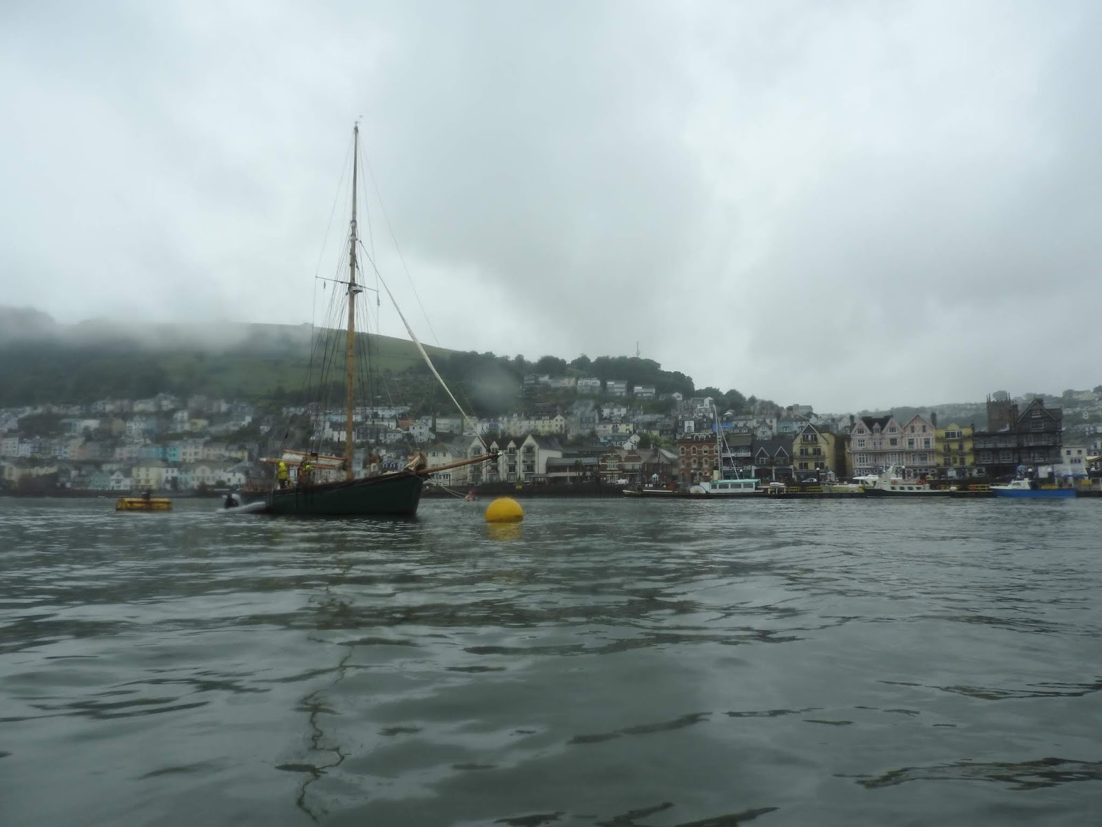
There was low cloud and slight drizzle when I started, but
the weather started to clear. Although there was low light for photography, the
weather effects made Dartmouth more atmospheric.
The colours and tones blended in a way that made everything
seem like an impressionist painting.
I looked up at the Britannia Royal Naval College where my uncle had trained,
starting aged 13 years. His first action was four years later, when at dawn on D-Day, his ship, the H M S Warspite bombarded enemy gun emplacements from eight miles offshore. He was attacked by E Boats, before forcing a retreat. His ship wore out their 15 inch guns and went back to Portsmouth. (see: http://stevespages.org.uk/pgm-greig/warspite.html)
As I exited, there were some yachts coming in, with the crews
trussed up in their sailing gear, having been voyaging in the rain.
The lack of wind and stillness, meant their conversation
carried over the sound of their engines and I heard one person talking about
PicoMicroYacht, saying ‘… and it has a radar reflector on the top of it’s mast
…’
At the mouth of the Dart Estuary I went along the southern
side of the channel.
The Kingwear Castle arrived, this ship being the last remaining operational coal fired paddle steamer in the UK.
It headed straight for me and
I wondered what evasive action I should take, if any.
It then became clear it was turning and having to create the
widest arc to go around smoothly.
Further down the coast was a reef with a series of rocks
called the Combe Rocks. Because of the calmness of the sea I decided to go between the Dancing Beggar and Combe Rocks rocks, gingerly moving forwards, also sticking to a path made by lobster pot
buoys. The Dancing Beggar rocks were to starboard.
Looking back towards Dartmouth I could see the rocks and also Mew Stone rock in the far distance. I was wondering whether low clouds would decend and create a fog.
Soon I was closing in on Torcross, with Start Point in the distance, the sea now silky smooth.
When I arrived, the tide was out but the small
stoned shingle beach made it easier to drag PicoMicroYacht upwards.
To make it easier I emptied the PicoMicrYacht of all gear,
including the rowing system, which is easily detachable.This reduced the weight to bare hull 60 kilograms.
I then rigged a bridle attached to bow and used a towing
technique. I walk two metres up the beach, faced PicoMicroYacht, and slipped the
bridle over my lower back. I then leant backwards. The weight of my
body provided enough force to slide PicoMicroYacht forwards for a few inches,
at which point I adjusted my legs and repeated the process.
PicoMicroyacht inched up the beach with
comparatively little effort. As the beach got steeper, I slalomed up it to
reduce the angle.
Because PicoMicroYacht moves so slowly, quite often people
see what I am doing and offer to help anyway.
I took a photograph of my radar reflector, which is set up so I can attach a navigation light on top.
Voyage details:
Plymouth high tide: 7.50 am
Tide: Springs
Left Dartmouth: Midday
Arrived Torcross: 3.30 pm
High tide Plymouth on 19 06 19 was 7.50. Set off at 12.00
midday when the tide turned south down Start Bay (four hours after high tide
Plymouth)